New Mombasa city center: Difference between revisions
From Halopedia, the Halo wiki
(→Trivia) |
m (Text replacement - "\|(right|thumb)(\|[^\]\n]+)?\|(right|thumb)" to "|thumb$2") |
||
| (54 intermediate revisions by 29 users not shown) | |||
| Line 1: | Line 1: | ||
{{ | {{Status|Canon}} | ||
[[File:Nm skyline 1.jpg|thumb|250px|The city center during the [[Battle of Mombasa]]. The [[Tanaga]] district and the [[NMPD headquarters]] can be seen to the right.]] | |||
The ''' | The '''city center''' of [[New Mombasa]] was a part of Mombasa Island. Portions of the city center were walled into multiple sections.{{Ref/Note|In [[Sadie's Story]], multiple areas seen in the ODST campaign are referred to as the city center. This includes [[Kikowani Station (location)|Kikowani Station]] (Audio log 1, Circle 1, Arc 1), [[ONI Alpha Site (location)|ONI Alpha Site]] and the [[New Mombasa Data Center]] (Audio log 8, Circle 3, Arc 2), the [[NMPD headquarters]] (Audio log 24, Circle 8, Arc 3), and the area in which the ''Solemn Penance'' arrived at (Audio log 3, Circle 1, Arc 3).}} | ||
= | The city center housed numerous massive skyscrapers, which easily dwarfed the buildings in the rest of the city. Many of the highest skyscrapers in the city center had 300 stories,<ref>[[:File:H3ODST Buildings Concept 2.jpg|''Halo 3: ODST'', concept art, detailing the buildings in the city center]]</ref> with the tallest being the [[Vyrant Telecom]] tower in the very center, reaching two kilometers in height.<ref>Measurable by using pan-cam coordinates: the height cap is at 615 WU, the building extends a bit over that, and 1WU=~3meters</ref> | ||
==History== | |||
On [[2552#October|October 20, 2552]], the [[Prophet of Regret|High Prophet of Regret]]'s [[Solemn Penance|Assault Carrier]] came to rest over the city center.<ref>''[[Sadie's Story]]'', [[Audio log (Halo 3: ODST)#Audio log 3, Circle 1, Arc 3|Circle 1, Arc 3]]</ref> Specifically at the [[Uplift Nature Reserve]].<ref>''Halo 3: ODST'', campaign level, [[Uplift Reserve]]</ref> Over the course of the battle, [[Stephen (Mombasa)|Stephen]] broadcasted messages from the [[NMPD headquarters]] in the city center.<ref>''Sadie's Story'', [[Audio log (Halo 3: ODST)#Audio log 24, Circle 8, Arc 3|Circle 8, Arc 3]]</ref> | |||
== | After around one hour{{Ref/Generic|Id=lootcrate2|Heading=[[Halo Legendary Crate]]|Subheading=[[Halo Legendary Crate/Data Drops|Data Drop #2]]}} of [[Battle of Mombasa|battle]], Regret's carrier initiated a [[Slipstream Space|Slipspace]] [[New Mombasa Slipspace Event|jump in the city]].<ref name="h2metropolis">''[[Halo 2]]'', campaign level, [[Metropolis]]</ref> Immediately after the slipspace event, the city center was occupied by the [[Jiralhanae]]-led remaining forces of Regret's [[Fleet of Sacred Consecration]],<ref>''Halo 3: ODST'', campagin level, [[Tayari Plaza]]</ref>{{Ref/Film|Id=Oct20|Film=Halo Waypoint|Story=Ten Twenty|StoryLinkText=Ten Twenty}} and was eventually [[Glassing|glassed]] by an [[Truth's fleet|excavation fleet]] on the next day.<ref name="h3odstcoastalhighway">''[[Halo 3: ODST]]'', campaign level, [[Coastal Highway]]</ref>{{Ref/Site|Id=waypointvergil|URL=https://www.halowaypoint.com/en-us/news/canon-fodder-vergil-reality|Site=Halo Waypoint|Page=Canon Fodder - Vergil Reality|D=15|M=06|Y=2021}} | ||
==Geography== | |||
The [[Tanaga]] district, which sat in the middle of the island, housed most of the city's skyscrapers.<ref name="h3odstnmpdhq">''Halo 3: ODST'', campaign level, [[NMPD HQ]]</ref> Further to the southeast sat several numbered districts.{{Ref/Reuse|h3odstmombasastreet}} [[New Mombasa Sector 10|Sector 10]], the southeast most point of the island,{{Ref/Reuse|h3odstmombasastreet}} housed a security zone for the [[ONI Alpha Site (location)|ONI Alpha Site]].<ref>''Sadie's Story'', [[Audio log (Halo 3: ODST)#Audio log 8, Circle 3, Arc 2|Circle 3, Arc 2]]</ref><ref>''Halo 3: ODST'', [[Field Operations Guide FM 90-10-140|Instruction Manual, Page 3]]</ref> | |||
*[[Tanaga]] | |||
**[[NMPD headquarters]] | |||
**[[Vyrant Telecom tower (Mombasa)|Vyrant Telecom tower]] | |||
*[[New Mombasa Sector 0|Sector 0]] | |||
*[[New Mombasa Sector 1|Sector 1]] | |||
*[[New Mombasa Sector 2|Sector 2]] | |||
*[[Kizingo]] | |||
**[[New Mombasa Sector 4|Sector 4]] | |||
**[[New Mombasa Sector 3|Sector 3]] | |||
**[[New Mombasa Sector 10|Sector 10]] | |||
***[[ONI Alpha Site (location)|ONI Alpha Site]] | |||
*[[Mbaraki]] | |||
**[[New Mombasa Sector 5|Sector 5]] | |||
***[[Tayari Plaza (location)|Tayari Plaza]] | |||
*[[Lumumba]] | |||
**[[New Mombasa Sector 6|Sector 6]] | |||
**[[New Mombasa Sector 9|Sector 9]] | |||
*[[New Mombasa Sector 7|Sector 7]] | |||
*[[New Mombasa Sector 8|Sector 8]] | |||
*[[Uplift Nature Reserve]] | |||
== | ==Government== | ||
The [[New Mombasa Transit Authority]] runs at least four [[Maglev train]] stations in the city center. This includes [[Kikowani Station (location)|Kikowani Station]].<ref name="h3odstmombasastreet">''Halo 3: ODST'', campaign level, [[Mombasa Streets]]</ref> The [[New Mombasa Waterfront Highway]] wraps around much of the city center.{{Ref/Reuse|h3odstcoastalhighway}} | |||
< | At the base of the [[Vyrant Telecom tower (Mombasa)|Vyrant Telecom tower]] was the [[NMPD headquarters]].{{Ref/Reuse|h3odstnmpdhq}} | ||
==Culture== | |||
===Architecture=== | |||
Much of the city center itself was part of a large, [[Wikipedia:arcology|arcology]]-like building complex which elevated it above the surrounding terrain. This superstructure was bordered by walls which sloped down to ground level. The [[Tanaga]] district, which was home to smaller buildings, was also located within this structure. | |||
All of the buildings in the area, including the walled complex on which the skyscrapers stood, followed a standardized, modular design aesthetic. Using metal and blue-green glass as the primary facade materials, most of the buildings were characterized by a flat shape, and were oriented similarly, with their razor-thin sides pointed southwest toward the Indian Ocean. The buildings were also arranged in a way that their height increased evenly on both sides toward the Vyrant tower in the center, giving New Mombasa a distinctive skyline. | |||
==Gallery== | |||
<gallery> | |||
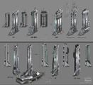
File:H3ODST Buildings Concept 1.jpg|Concept designs of the city center's architecture. | |||
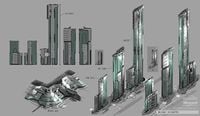
File:H3ODST Buildings Concept 2.jpg|Concept designs of the city center's architecture. | |||
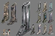
File:H3ODST Buildings Concept 3.jpg|Concept designs of the city center's architecture. | |||
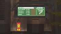
File:H2 Mombasa HighwaySign.jpg|A sign showing the city center closed during the Covenant invasion. | |||
File:Nm center.jpg|The city center at night. | |||
File:New Mombasa City Center Night Station.png|The city center at night seen from [[Kikowani Station (location)|Kikowani Station]]. | |||
File:Ad NMTA.png|New Mombasa's skyline as depicted in an advertisement for [[New Mombasa Transit Authority]]. | |||
</gallery> | |||
==List of appearances== | |||
*''[[Halo 2]]'' {{Fm}} | |||
*''[[Halo 3: ODST]]'' {{1st}} | |||
*''[[Halo 2: Anniversary]]'' {{Mo}} | |||
==Notes== | |||
{{Ref/Notes}} | |||
==Sources== | |||
{{Ref/Sources}} | |||
{{MombasaLocales}} | |||
Latest revision as of 11:30, April 12, 2023
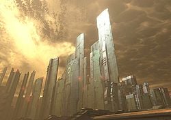
The city center of New Mombasa was a part of Mombasa Island. Portions of the city center were walled into multiple sections.[Note 1]
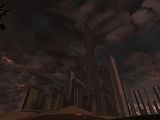
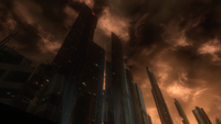
The city center housed numerous massive skyscrapers, which easily dwarfed the buildings in the rest of the city. Many of the highest skyscrapers in the city center had 300 stories,[1] with the tallest being the Vyrant Telecom tower in the very center, reaching two kilometers in height.[2]
History[edit]
On October 20, 2552, the High Prophet of Regret's Assault Carrier came to rest over the city center.[3] Specifically at the Uplift Nature Reserve.[4] Over the course of the battle, Stephen broadcasted messages from the NMPD headquarters in the city center.[5]
After around one hour[6] of battle, Regret's carrier initiated a Slipspace jump in the city.[7] Immediately after the slipspace event, the city center was occupied by the Jiralhanae-led remaining forces of Regret's Fleet of Sacred Consecration,[8][9] and was eventually glassed by an excavation fleet on the next day.[10][11]
Geography[edit]
The Tanaga district, which sat in the middle of the island, housed most of the city's skyscrapers.[12] Further to the southeast sat several numbered districts.[13] Sector 10, the southeast most point of the island,[13] housed a security zone for the ONI Alpha Site.[14][15]
Government[edit]
The New Mombasa Transit Authority runs at least four Maglev train stations in the city center. This includes Kikowani Station.[13] The New Mombasa Waterfront Highway wraps around much of the city center.[10]
At the base of the Vyrant Telecom tower was the NMPD headquarters.[12]
Culture[edit]
Architecture[edit]
Much of the city center itself was part of a large, arcology-like building complex which elevated it above the surrounding terrain. This superstructure was bordered by walls which sloped down to ground level. The Tanaga district, which was home to smaller buildings, was also located within this structure.
All of the buildings in the area, including the walled complex on which the skyscrapers stood, followed a standardized, modular design aesthetic. Using metal and blue-green glass as the primary facade materials, most of the buildings were characterized by a flat shape, and were oriented similarly, with their razor-thin sides pointed southwest toward the Indian Ocean. The buildings were also arranged in a way that their height increased evenly on both sides toward the Vyrant tower in the center, giving New Mombasa a distinctive skyline.
Gallery[edit]
The city center at night seen from Kikowani Station.
New Mombasa's skyline as depicted in an advertisement for New Mombasa Transit Authority.
List of appearances[edit]
- Halo 2 (First mentioned)
- Halo 3: ODST (First appearance)
- Halo 2: Anniversary (Mentioned only)
Notes[edit]
- ^ In Sadie's Story, multiple areas seen in the ODST campaign are referred to as the city center. This includes Kikowani Station (Audio log 1, Circle 1, Arc 1), ONI Alpha Site and the New Mombasa Data Center (Audio log 8, Circle 3, Arc 2), the NMPD headquarters (Audio log 24, Circle 8, Arc 3), and the area in which the Solemn Penance arrived at (Audio log 3, Circle 1, Arc 3).
Sources[edit]
- ^ Halo 3: ODST, concept art, detailing the buildings in the city center
- ^ Measurable by using pan-cam coordinates: the height cap is at 615 WU, the building extends a bit over that, and 1WU=~3meters
- ^ Sadie's Story, Circle 1, Arc 3
- ^ Halo 3: ODST, campaign level, Uplift Reserve
- ^ Sadie's Story, Circle 8, Arc 3
- ^ Halo Legendary Crate - Data Drop #2
- ^ Halo 2, campaign level, Metropolis
- ^ Halo 3: ODST, campagin level, Tayari Plaza
- ^ Halo Waypoint - Ten Twenty
- ^ a b Halo 3: ODST, campaign level, Coastal Highway
- ^ Halo Waypoint, Canon Fodder - Vergil Reality (Retrieved on Jun 15, 2021) [archive]
- ^ a b Halo 3: ODST, campaign level, NMPD HQ
- ^ a b c Halo 3: ODST, campaign level, Mombasa Streets
- ^ Sadie's Story, Circle 3, Arc 2
- ^ Halo 3: ODST, Instruction Manual, Page 3
| ||||||||||||||||||||||||||||||||
