Breakneck: Difference between revisions
From Halopedia, the Halo wiki
BaconShelf (talk | contribs) |
m (Text replacement - "{{Levels|HR|mode=yes}}↵{{Levels|HCEA|mode=yes}}" to "{{Levels|CEA|mode=yes}}") |
||
| (27 intermediate revisions by 11 users not shown) | |||
| Line 1: | Line 1: | ||
{{ | {{Status|Gameplay}} | ||
{{Multiplayer | {{Multiplayer map infobox | ||
|pagegamelabel=HR | |||
|name=Breakneck | |name=Breakneck | ||
|image=[[File: | |image=[[File:HR Breakneck Panorama.png|300px]] | ||
|game=''[[Halo: | |game=''[[Halo: Reach]]'' | ||
*''[[Anniversary Map Pack]]'' | |||
|devname=<code>cex_headlong</code>{{Ref/File|Id=HREK|HREK|HREK\tags\levels\dlc\cex_headlong\cex_headlong.scenario}} | |||
|playernumber=8-16 | |playernumber=8-16 | ||
|location=[[Section 21]], [[New Mombasa]], [[Earth]] | |location=[[Section 21]], [[New Mombasa]], [[East African Protectorate]], [[Earth]] | ||
|terrain=Human urban terrain, construction site | |terrain=Human urban terrain, construction site | ||
|gametypes=*[[Big Team | |gametypes=*[[Big Team Slayer]] | ||
*[[Race]] | |||
*[[Rally]] | |||
*[[Rocket Race]] | |||
}} | }} | ||
{{Article | {{Article quote|The initial Covenant strike is over, but the [[Battle of Mombasa|fight for Mombasa]] has just begun.}} | ||
'''Breakneck''' is a [[multiplayer]] map included in ''[[Halo: Combat Evolved Anniversary]]'' for ''[[Halo: Reach]]''. It is a remake of ''[[Headlong]]'' from ''[[Halo 2]]''. | '''Breakneck''' is a [[multiplayer]] map included in ''[[Halo: Combat Evolved Anniversary]]'' and the [[Anniversary Map Pack]] for ''[[Halo: Reach]]''. It is a remake of ''[[Headlong]]'' from ''[[Halo 2]]''.{{Ref/Site|Id=info|D=01|M=6|Y=2020|URL=http://halo.xbox.com/blogs/Headlines/post/2011/09/14/The-Halo-Bulletin-91411-.aspx|Site=Halo Waypoint|Page=The Halo Bulletin: 9/14/11|Detail=(Defunct)}}{{Ref/Site|D=01|M=6|Y=2020|URL=http://www.halowaypoint.com/en-us/games/haloanniversary/detail?title=halo-anniversary-images&id=ba1eeec4-0c73-49a6-a57f-c32ce1bf2c68|Site=Halo Waypoint|Page=Halo: Anniversary Images|Detail=(Defunct, copy on [https://web.archive.org/web/20141012165515/https://www.halowaypoint.com/en-us/games/haloanniversary/detail?title=halo-anniversary-images&id=ba1eeec4-0c73-49a6-a57f-c32ce1bf2c68 Wayback Machine])}} It is the only ''Halo: Reach'' multiplayer map to be set on Earth. | ||
== | ==Universe and lore== | ||
Breakneck is set in the [[city]] of [[New Mombasa]], in a part of the [[New Mombasa Docks|docks]] known as [[Section 21]], which closely resembles the [[Section 14]] featured in Headlong. The area is lined by buildings on all but one side, which opens up to the sea with a view of a structure resembling the [[Uplift Nature Reserve]] and the [[New Mombasa city center|city center]]. The playable area is dominated by a [[New Branch Construction|New Branch construction site]], a [[Unidentified hotel|hotel]] and an elevated road under construction. | |||
New Mombasa's [[Superintendent]] is seemingly connected to the area, as its avatar can be seen on many parts of the map. The advertisement for the civilian [[Hog]] still appears on this map. | |||
== | ==Overview== | ||
===Layout=== | |||
<gallery> | |||
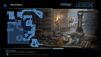
File:HMCC_HR_Breakneck_Map.png|Breakneck Map. | |||
File:HA - Breakneck Overview.jpeg|An overhead view of the map. | |||
</gallery> | |||
====Callouts==== | |||
The following are locations on the map that are so named on the player's [[heads-up display]] during gameplay: | The following are locations on the map that are so named on the player's [[heads-up display]] during gameplay: | ||
{{col-begin}} | {{col-begin}} | ||
| Line 24: | Line 36: | ||
*Ocean Wall | *Ocean Wall | ||
*Roadway | *Roadway | ||
*Hotel | <gallery> | ||
File:HR Breakneck Evacuation.jpg|The back alley portion of Roadway | |||
</gallery> | |||
*[[Unidentified hotel|Hotel]] | |||
*Hotel Balcony | *Hotel Balcony | ||
*Underpass | *Underpass | ||
* | *Footbridge | ||
*Monument | *Monument | ||
*Freight Hallway | *Freight Hallway | ||
| Line 49: | Line 64: | ||
*Construction 3rd Floor | *Construction 3rd Floor | ||
*Construction Scaffolding | *Construction Scaffolding | ||
*Out of Bounds | |||
{{col-end}} | {{col-end}} | ||
| Line 55: | Line 71: | ||
*On the southern sea wall of the map, [[Original map screenshot Easter egg|a screenshot of ''Headlong'']] can be found. | *On the southern sea wall of the map, [[Original map screenshot Easter egg|a screenshot of ''Headlong'']] can be found. | ||
*The placement of the map in New Mombasa appears to be inconsistent with the city's ''Halo 3: ODST'' incarnation. Assuming the locations of the city's landmarks, such as the bridge of the Uplift Reserve, are consistent with ''ODST'', the map should be situated near the southernmost main section of the Reserve. No skyscrapers or streets are present in the area in ''ODST''.<ref>[[:File:Uplift rings.jpg]]</ref> In addition, according to the player's HUD compass, the city center and the Mombasa tether are situated to the south and southwest of the map, respectively. Based on the way the city is presented in ''ODST'', the aforementioned landmarks would be located to the north and northwest of the Uplift Reserve and thus the map's playable area. | *The placement of the map in New Mombasa appears to be inconsistent with the city's ''Halo 3: ODST'' incarnation. Assuming the locations of the city's landmarks, such as the bridge of the Uplift Reserve, are consistent with ''ODST'', the map should be situated near the southernmost main section of the Reserve. No skyscrapers or streets are present in the area in ''ODST''.<ref>[[:File:Uplift rings.jpg]]</ref> In addition, according to the player's HUD compass, the city center and the Mombasa tether are situated to the south and southwest of the map, respectively. Based on the way the city is presented in ''ODST'', the aforementioned landmarks would be located to the north and northwest of the Uplift Reserve and thus the map's playable area. | ||
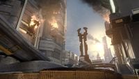
*The monument that resembles the [[Seventh Column]] near the water has noticeably changed since ''Halo 2''. This is because the symbol is [[Bungie]]'s registered trademark. | |||
==Gallery== | ==Gallery== | ||
{{Linkbox|gallery=yes}} | |||
<gallery> | <gallery> | ||
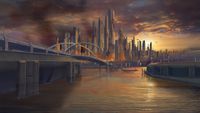
File:HR_Breakneck_Concept.jpg|Concept art of the map. | File:HR_Breakneck_Concept.jpg|Concept art of the map. | ||
File: | File:HR_Breakneck_Concept_2.jpg|Concept art of the skybox of the map. | ||
File: | File:HR Breakneck 1.jpg|The monument at the map's center. | ||
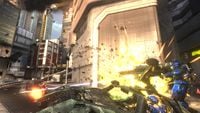
File: | File:HR_Breakneck_Action_1.jpg | ||
File: | File:HR_Breakneck_Action_2.jpg | ||
File: | File:HR_Breakneck_Action_3.jpg | ||
File: | File:HR_Breakneck_Action_4.jpg | ||
File: | File:HR Breakneck Action 5.jpg | ||
File: | File:HR Breakneck Superintendent 1.png|The [[Superintendent]] on Breakneck. | ||
File: | File:HR Breakneck Superintendent 2.png|A construction poster of the Superintendent on Breakneck. | ||
File:Civilian Warthog in Halo Anniversary.jpg|The 'Hog advertisement on the map. | |||
</gallery> | </gallery> | ||
==Sources== | ==Sources== | ||
{{Ref/Sources}} | |||
{{Levels| | {{Levels|CEA|mode=yes}} | ||
[[Category:Halo: Reach multiplayer maps]] | |||
Revision as of 12:33, June 30, 2024
| Breakneck | |
|---|---|
| |
| Map overview | |
|
Game: |
|
|
Map file name (?): |
|
| Lore information | |
|
Location: |
|
| Gameplay overview | |
|
Terrain: |
Human urban terrain, construction site |
|
Recommended number of players: |
8-16 |
|
Recommended gametype(s): |
|
| “ | The initial Covenant strike is over, but the fight for Mombasa has just begun. | ” |
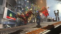
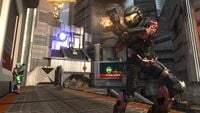
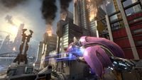
Breakneck is a multiplayer map included in Halo: Combat Evolved Anniversary and the Anniversary Map Pack for Halo: Reach. It is a remake of Headlong from Halo 2.[2][3] It is the only Halo: Reach multiplayer map to be set on Earth.
Universe and lore
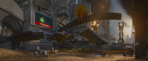
Breakneck is set in the city of New Mombasa, in a part of the docks known as Section 21, which closely resembles the Section 14 featured in Headlong. The area is lined by buildings on all but one side, which opens up to the sea with a view of a structure resembling the Uplift Nature Reserve and the city center. The playable area is dominated by a New Branch construction site, a hotel and an elevated road under construction.
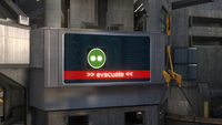
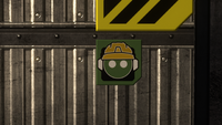
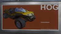
New Mombasa's Superintendent is seemingly connected to the area, as its avatar can be seen on many parts of the map. The advertisement for the civilian Hog still appears on this map.
Overview
Layout
- HA - Breakneck Overview.jpeg
An overhead view of the map.
Callouts
The following are locations on the map that are so named on the player's heads-up display during gameplay:
|
|
Trivia
- The location of the map in New Mombasa, Section 21, is a reference to Section 14, the setting of Headlong. Both are also 7 references, as 14 and 21 are consecutive multiples of 7.
- On the southern sea wall of the map, a screenshot of Headlong can be found.
- The placement of the map in New Mombasa appears to be inconsistent with the city's Halo 3: ODST incarnation. Assuming the locations of the city's landmarks, such as the bridge of the Uplift Reserve, are consistent with ODST, the map should be situated near the southernmost main section of the Reserve. No skyscrapers or streets are present in the area in ODST.[4] In addition, according to the player's HUD compass, the city center and the Mombasa tether are situated to the south and southwest of the map, respectively. Based on the way the city is presented in ODST, the aforementioned landmarks would be located to the north and northwest of the Uplift Reserve and thus the map's playable area.
- The monument that resembles the Seventh Column near the water has noticeably changed since Halo 2. This is because the symbol is Bungie's registered trademark.
Gallery

|
Browse more images in this article's gallery page. |
The Superintendent on Breakneck.
Sources
- ^ Halo: Reach Editing Kit, game file
HREK\tags\levels\dlc\cex_headlong\cex_headlong.scenario - ^ Halo Waypoint, The Halo Bulletin: 9/14/11: (Defunct) (Retrieved on Jun 1, 2020) [archive]
- ^ Halo Waypoint, Halo: Anniversary Images: (Defunct, copy on Wayback Machine) (Retrieved on Jun 1, 2020) [archive]
- ^ File:Uplift rings.jpg
