Mombasa: Difference between revisions
From Halopedia, the Halo wiki
BaconShelf (talk | contribs) m (→Concept Art) |
CMDR RileySV (talk | contribs) (Made some minor adjustments. Changed up and added a lot more images.) |
||
| Line 20: | Line 20: | ||
===Interstellar Era=== | ===Interstellar Era=== | ||
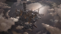
[[File: | [[File:HSS-Mombasa Tether.png|thumb|200px|The [[New Mombasa Orbital Elevator]].]] | ||
Mombasa underwent dramatic change with the arrival of the interstellar era. In response to increasing demand for cheap orbital access, due to its economic stability and prominent location, Mombasa was chosen to be Earth's first [[Space elevator|Space Elevator]] city.<ref name="waypoint">''[[Halo Waypoint]]'', "Space Elevator" article (Archived on [https://web.archive.org/web/20111007185941/http://halo.xbox.com/en-us/intel/theuniverse/locations/gallery/space-tether/e9b2f438-9b5b-477e-8e52-d4e6801e9d5b Archive.org])</ref> The government began construction on one of the wonders of the age: a space elevator (Mombasa's proximity to the equator made it an ideal location) in [[2302]].<ref name="bnet" /> This structure served to lift heavy cargo into geosynchronous orbit without expensive booster rockets filled with fuel. | Mombasa underwent dramatic change with the arrival of the interstellar era. In response to increasing demand for cheap orbital access, due to its economic stability and prominent location, Mombasa was chosen to be Earth's first [[Space elevator|Space Elevator]] city.<ref name="waypoint">''[[Halo Waypoint]]'', "Space Elevator" article (Archived on [https://web.archive.org/web/20111007185941/http://halo.xbox.com/en-us/intel/theuniverse/locations/gallery/space-tether/e9b2f438-9b5b-477e-8e52-d4e6801e9d5b Archive.org])</ref> The government began construction on one of the wonders of the age: a space elevator (Mombasa's proximity to the equator made it an ideal location) in [[2302]].<ref name="bnet" /> This structure served to lift heavy cargo into geosynchronous orbit without expensive booster rockets filled with fuel. | ||
| Line 49: | Line 49: | ||
The moniker of Old Mombasa was applied to all municipalities in a 74km radius of Mombasa,<ref name="bnet" /> which would include some towns in [[Wikipedia:Kwale County|Kwale County]] and [[Wikipedia:Kilifi County|Kilifi County]]. | The moniker of Old Mombasa was applied to all municipalities in a 74km radius of Mombasa,<ref name="bnet" /> which would include some towns in [[Wikipedia:Kwale County|Kwale County]] and [[Wikipedia:Kilifi County|Kilifi County]]. | ||
{{Featurelist|secondcolumn=title-2|title-1=Major Locations| | {{Featurelist|secondcolumn=title-2|title-1=Major Locations| | ||
*[[Grid Kilo 23]] | *[[Grid Kilo 23]] | ||
| Line 85: | Line 84: | ||
While the majority of New Mombasa has been divided to numbered sectors, some districts such as [[Mbaraki]], [[Kizingo]] or [[Kikowani]] still retain their original names. The original names are often seen in the names of streets or train stations, for example. Some of the districts' names have changed, albeit slightly; areas originally referred to as Tangana and Liwatoni are now referred to as [[Tanaga]] and Liwitoni, respectively. The locations of some districts have changed as well. This is the case with most of the districts on the southern side of the island, where the sea has claimed large areas of land.<ref name="coastal" /> | While the majority of New Mombasa has been divided to numbered sectors, some districts such as [[Mbaraki]], [[Kizingo]] or [[Kikowani]] still retain their original names. The original names are often seen in the names of streets or train stations, for example. Some of the districts' names have changed, albeit slightly; areas originally referred to as Tangana and Liwatoni are now referred to as [[Tanaga]] and Liwitoni, respectively. The locations of some districts have changed as well. This is the case with most of the districts on the southern side of the island, where the sea has claimed large areas of land.<ref name="coastal" /> | ||
On the outskirts of New Mombasa existed an industrial wasteland where a [[ | On the outskirts of New Mombasa existed an industrial wasteland where a [[Unnamed UNSC munitions testing complex|UNSC munitions testing complex]] existed.<ref>[http://halo.bungie.net/News/content.aspx?type=topnews&cid=12358 ''Bungie.net'', An Affinity for Art]</ref> | ||
{{Featurelist|secondcolumn=title-3|title-1=Industrial zone| | {{Featurelist|secondcolumn=title-3|title-1=Industrial zone| | ||
{{Main|New Mombasa industrial zone}} | {{Main|New Mombasa industrial zone}} | ||
| Line 186: | Line 184: | ||
Multiple media organizations exist within Mombasa. The city has two newspapers, the [[Daily Bulletin]] and [[The Mombasa Times]].<ref name="ani" /> | Multiple media organizations exist within Mombasa. The city has two newspapers, the [[Daily Bulletin]] and [[The Mombasa Times]].<ref name="ani" /> | ||
===Architecture=== | ===Architecture=== | ||
[[File:H2A Campaign OldMombasaCity.png|thumb|right|200px|The variety of architecture in Mombasa.]] | |||
The architecture of the city is different depending on the location. Old Mombasa's architecture was an odd hodgepodge of old and new: 16th-century Muslim arcades, aging 21st-century office buildings, looming 26th-century power couplings, old concrete homes secured with computerized locks. Clotheslines strung next to power lines, and mechanical gates set into ancient brick walls.<ref name="halo2" /><ref name="ani" /> In some areas, newer skyscrapers had found their home.<ref name="coastal" /><ref>''[[Halo: Reach]]'', multiplayer map, [[Breakneck]]</ref> | The architecture of the city is different depending on the location. Old Mombasa's architecture was an odd hodgepodge of old and new: 16th-century Muslim arcades, aging 21st-century office buildings, looming 26th-century power couplings, old concrete homes secured with computerized locks. Clotheslines strung next to power lines, and mechanical gates set into ancient brick walls.<ref name="halo2" /><ref name="ani" /> In some areas, newer skyscrapers had found their home.<ref name="coastal" /><ref>''[[Halo: Reach]]'', multiplayer map, [[Breakneck]]</ref> | ||
| Line 212: | Line 211: | ||
*[[Unnamed NMPD Officer]] | *[[Unnamed NMPD Officer]] | ||
*[[Melody Azikiwe]] | *[[Melody Azikiwe]] | ||
{{Linkbox|gallery=yes}} | |||
==Gallery== | ==Gallery== | ||
===Concept Art=== | ===Concept Art=== | ||
| Line 217: | Line 217: | ||
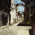
File:H2 OldMombasa Concept.png|Concept art of a street in Old Mombasa. | File:H2 OldMombasa Concept.png|Concept art of a street in Old Mombasa. | ||
File:H3ODST_TetherBase_Concept_2.jpg|Concept art of the Orbital Elevator. | File:H3ODST_TetherBase_Concept_2.jpg|Concept art of the Orbital Elevator. | ||
File:H2A-pavel-belov-metropolis-opening.jpg|Concept art of the battle on the suspension bridge. | |||
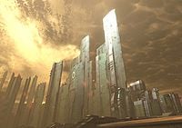
File:HR Breakneck Concept 2.jpg|Concept of the Mombasa skyline. | |||
</gallery> | </gallery> | ||
| Line 224: | Line 226: | ||
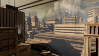
File:Old Mombasa.jpg|The skyline of Old Mombasa. | File:Old Mombasa.jpg|The skyline of Old Mombasa. | ||
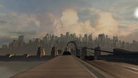
New Mombasa Bridge.png|A view of the suspension bridge from Old Mombasa. | New Mombasa Bridge.png|A view of the suspension bridge from Old Mombasa. | ||
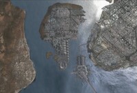
File:H2A - Sector0-5Aerial.png|An overview of a part of Old Mombasa. | |||
</gallery> | </gallery> | ||
| Line 230: | Line 233: | ||
File:Mombasa_skyline.jpg|The skyline of New Mombasa. | File:Mombasa_skyline.jpg|The skyline of New Mombasa. | ||
File:Uplift bridge.jpg|Uplift Nature Preserve. | File:Uplift bridge.jpg|Uplift Nature Preserve. | ||
File:HR Mombasa Skyline.png|The city center of New Mombasa. | |||
File:Mombasa area.png|Mombasa area after the [[Battle of Mombasa]]. | File:Mombasa area.png|Mombasa area after the [[Battle of Mombasa]]. | ||
File:Mombasa | File:H2A-ADatB-Mombasa.jpg|Northwestern New Mombasa. | ||
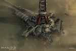
File:HSS-Gameplay-City Tour.jpg|A simulated version of the battle in New Mombasa. | |||
</gallery> | </gallery> | ||
Revision as of 21:59, November 7, 2019
| There is more information available on this subject at Mombasa on the English Wikipedia. |
| Mombasa | |
|---|---|
| |
| Overview | |
|
Location: |
|
|
Notable structure(s): |
|
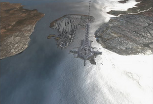
Mombasa is a city in the Kenyan portion of the East African Protectorate on Earth. The heart of the city was the prosperous New Mombasa on Mombasa Island. The nearby mainland was the site of Old Mombasa, a comparatively run-down district.[1]
Mombasa was the site of Earth's first Space elevator[1] and centuries later, was a battlefield in the climatic year of the Human-Covenant War.[2][3]
History
Pre-2300s
The exact founding date of the city is unknown, but it has a long history. It must have been already a prosperous trading town in the 12th century, as one of its earliest mentions is from 1151. Mombasa had always been an important port of the Indian Ocean trade routes and was captured and recaptured countless times by a variety of powers including Portugal, the United Kingdom, and various Arab forces. This violent history led to its Swahili nickname "Kisiwa Cha Mvita," or "Island of War." The city became part of the independent nation of Kenya in the 20th century. During this era, Mombasa became a tourist destination, boasting numerous resorts and clean white beaches. It was also important as a port city, connecting East Africa to the Indian Ocean.[4]
Interstellar Era
Mombasa underwent dramatic change with the arrival of the interstellar era. In response to increasing demand for cheap orbital access, due to its economic stability and prominent location, Mombasa was chosen to be Earth's first Space Elevator city.[5] The government began construction on one of the wonders of the age: a space elevator (Mombasa's proximity to the equator made it an ideal location) in 2302.[1] This structure served to lift heavy cargo into geosynchronous orbit without expensive booster rockets filled with fuel.
Over the next eleven years the city experienced explosive growth, but nothing compared to what followed. The city grew out as well as up, its urban sprawl unequaled throughout the continent.[1]
Mombasa would change dramatically within the centuries that followed. By 2430, New Mombasa had absorbed the entire island and many of the surrounding towns, which became overrun by residents of Mombasa. The switch of name was never official, and though many of the neighborhoods within direct line of sight to the Mombasa Tether still distributed newspapers and Chatter directories under their previous names, all municipalities within a 74 km radius of the island became referred to as "Old Mombasa."[1]
On December 19, 2512, the Superintendent was activated to manage the city's infrastructure.[6]
Covenant Invasion
- Main article: Battle of Mombasa
On October 20, 2552, a small group of Covenant capital ships arrived at Earth. Uninformed of the Human presence on Earth, Regret was outnumbered and outgunned against the UNSC Home Fleet. During the orbital battle, the Prophet of Regret's Flagship broke through Earth's defenses and descended to the atmosphere, and anchored itself above New Mombasa.[2] The Covenant started deploying their ground forces to the city, in search of a Forerunner relic, the Ark Portal, buried under the city.[7]
However, due to a strong UNSC counterattack and the inferior numbers of the Covenant, Regret ordered all of his forces to be evacuated back aboard the Carrier. After this, the ship jumped into slipspace just above the city, releasing a shockwave and pulling multiple city blocks from the mainland with it.[3] This event became known as the "New Mombasa Slipspace Event."[8] In the hours after Regret's retreat, a larger Covenant fleet arrived at Earth. After sending in ground forces and crushing the remaining UNSC resistance in the city, they glassed the area in order to uncover the Portal.[9] In the final days of the Battle for Earth, only smoldering ruins of Mombasa remained.[10]
Post-war
Following the end of the war, the Unified Earth Government began Project Rebirth to rehabilitate war torn areas on Earth.[11] At some point, the Project started work in Mombasa. The old city hall thoroughfare for Mombasa was to be transformed into the UNSC Memorial Park.[12]
Geography
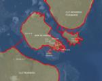
Mombasa Island, where the metropolis of New Mombasa lies, is separated from the mainland by two creeks: Tudor Creek to the north and Kilindini Harbour to the south. Northwest of the island and between the inlets, there used to be a large peninsula, connected to the Mombasa island by the Makupa Causeway.[note 1]
Old Mombasa
- Main article: Old Mombasa
Much of the mainland was known as Old Mombasa. This includes parts of Likoni, south and southwest of Kilindini Harbour.[2][13]
The moniker of Old Mombasa was applied to all municipalities in a 74km radius of Mombasa,[1] which would include some towns in Kwale County and Kilifi County.
Sectors
|
New Mombasa
- Main article: New Mombasa
New Mombasa encompasses the entirety of Mombasa Island,[1] as well as some mainland territories.[13]
The City Center spans much of the Southeast portion of the island, being divided in multiple walled sectors.[note 2]
While the majority of New Mombasa has been divided to numbered sectors, some districts such as Mbaraki, Kizingo or Kikowani still retain their original names. The original names are often seen in the names of streets or train stations, for example. Some of the districts' names have changed, albeit slightly; areas originally referred to as Tangana and Liwatoni are now referred to as Tanaga and Liwitoni, respectively. The locations of some districts have changed as well. This is the case with most of the districts on the southern side of the island, where the sea has claimed large areas of land.[9]
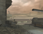
On the outskirts of New Mombasa existed an industrial wasteland where a UNSC munitions testing complex existed.[14]
Industrial zone |
Other
|
Government
The Superintendent, a second generation "dumb-AI,"[6] managed many of the municipal functions in New Mombasa[15] and in Old Mombasa.[16]
The transit of Mombasa is run by the New Mombasa Transit Authority. They are known to operate the extensive Maglev train network within the city.[15][17]
The New Mombasa Police Department is the police force of the city. They have stations in Old Mombasa[16] and their headquarters is located in New Mombasa.[18]
The waste management of the city is handled by the New Mombasa Waste Management. They operate all sorts of garbage cans throughout New Mombasa and Old Mombasa. They also operate the Olifant.[9]
The parks and greenspace of Mombasa are handled by the New Mombasa Parks and Recreation. They managed the Uplift Nature Reserve,[9] and most likely the Kilindini Park Cultural Center.
Mail in New Mombasa was handled by the NMPost.[15]
Economy
The economy of Mombasa is vast, ranging from interstellar/multi-planetary corporations of varying sectors to smaller local Earth businesses.
Corporations in city
Interstellar/Multi-planetary |
Unknown
|
Culture
Media
Multiple media organizations exist within Mombasa. The city has two newspapers, the Daily Bulletin and The Mombasa Times.[16]
Architecture
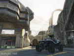
The architecture of the city is different depending on the location. Old Mombasa's architecture was an odd hodgepodge of old and new: 16th-century Muslim arcades, aging 21st-century office buildings, looming 26th-century power couplings, old concrete homes secured with computerized locks. Clotheslines strung next to power lines, and mechanical gates set into ancient brick walls.[2][16] In some areas, newer skyscrapers had found their home.[9][19]
New Mombasa is composed differently. In some areas there is more use of a commercial focused arcology,[15] while in another, it is more focused on industrial design.[3]
People
The culture also seems displaced between the different parts of the city; while New Mombasa was populated with industrial workers and ambitious cosmopolitans, Old Mombasa was considered to be more of an old rundown slum that deteriorates by the day. The denizens of the old city were largely isolated from the residents of New Mombasa; even their dialect was completely different from the standard language.[7]
Other
Mombasa also had its own circus called the Mombasa Circus. As well, rock concerts were held in the city by bands such as Fluke of the Narwal.[16]
Known Residents
- Sadie Endesha
- Daniel Endesha
- Mike Branley
- Roberto Bustamante
- Jim Odingo
- Marshall Glick
- Carlos Wambua
- Tom Uberti
- Melody Azikiwe
- Kinsler
- Jonas
- Stephen
- Communications Duty Officer
- Unnamed NMPD Officer
- Melody Azikiwe

|
Browse more images in this article's gallery page. |
Gallery
Concept Art
Old Mombasa
New Mombasa
Mombasa area after the Battle of Mombasa.
Maps and Overviews
- Mombasa today.png
A satellite view of Mombasa during the 21st century.
Other
- 1225615107 Mombasabridge.JPG
The Mombasa Suspension bridge, shown to scale on Google Earth.
List of appearances
- I love bees (First mentioned)
- Halo 2 (First appearance)
- Halo Graphic Novel
- Halo: Ghosts of Onyx (Mentioned only)
- Halo 3
- Halo 3: ODST
- Halo: Evolutions
- Halo: Reach
- Halo: Spartan Strike
- Halo: New Blood
- Hunt the Truth (Mentioned only)
- Halo: Spartan Strike
- Halo Mythos
- Halo: Legacy of Onyx (Mentioned only)
- Halo: Bad Blood (Mentioned only)
- Halo: Renegades
Notes
- ^ This landmass was shown to be covered by water in Halo 3: ODST. This could be explained by the dramatic climbing of sea levels due to global warming, whose results are evident throughout Mombasa. Or by the creation of an artificial seaway that reaches further inland. It's also possible that this simply wasn't created for the in-game area as the only way to see that far west is in Panoramic Camera Mode
- ^ In Sadie's Story, multiple areas seen in the ODST campaign are referred to as the city center. This includes Kikowani Station (Audio log 1, Circle 1, Arc 1), ONI Alpha Site and the New Mombasa Data Center (Audio log 8, Circle 3, Arc 2), the NMPD Headquarters (Audio log 24, Circle 8, Arc 3), and the area in which the Solemn Penance arrived at (Audio log 3, Circle 1, Arc 3).
Sources
- ^ a b c d e f g Bungie.net: Field Guide entry: New Mombasa
- ^ a b c d Halo 2, campaign level, Outskirts
- ^ a b c Halo 2, campaign level, Metropolis
- ^ Mombasa on Wikipedia
- ^ Halo Waypoint, "Space Elevator" article (Archived on Archive.org)
- ^ a b Halo Waypoint: Superintendent
- ^ a b Halo Graphic Novel, "Second Sunrise Over New Mombasa"
- ^ Halo 3, multiplayer map, High Ground
- ^ a b c d e Halo 3: ODST, campaign level, Coastal Highway
- ^ Halo 3, campaign level, Tsavo Highway
- ^ Halo: Legacy of Onyx, Chapter 2
- ^ McFarlane Toys/Halo Point Prizes, Master Chief Statue Press Release
- ^ a b Halo Waypoint: New Mombasa
- ^ Bungie.net, An Affinity for Art
- ^ a b c d Halo 3: ODST, campaign level, Mombasa Streets
- ^ a b c d e Halo 2: Anniversary, campaign level, Outskirts
- ^ Halo 2, multiplayer map, Terminal
- ^ Halo 3: ODST, campaign level, NMPD HQ
- ^ Halo: Reach, multiplayer map, Breakneck
| ||||||||||||||||||||||||||||||||
